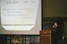
| Nobuyoshi Fugono |
 |
|
|
 |
 |
|
[Slide 1]
[Slide 2]
[Slide 3]
[Slide 4]
[Slide 5]
[Slide 6]
[Slide 7]
|
It is not that I don't use a computer because I'm not young enough, but I prefer using View-graphs because I believe in their spontaneous power.
[Slide 1]
My background is in electronics. In 1961, I started the observation of the upper atmosphere using the sounding rocket launched by the Institute of Industrial Science University of Tokyo from the Michikawa Coast in Akita. Dr. Yasuoka now belongs to this Institute. It was the starting of my research career - a good way to say, in the field of space science. After working for 10 years in the same research field, from 1972, the year after Japan's first scientific satellite "SHINSEI" was launched, I started working at NASA's Goddard Space Flight Center.
At that time, I was doing the research of the optical photochemical reactions in the upper atmosphere. I belonged to the Laboratory for Planetary Atmosphere, and met the director of the neighboring Laboratory for Atmosphere, Dr. Nordberg, who was very friendly and kind to me. He liked to say that his name was 'Kitayama' in Japanese. Dr. Norberg had immigrated from Germany and studied at Chicago University. He was friends with Dr. Fujita, the leading authority on tornados in the USA who also studied there. Dr. Fujita was the person who later found the 'downburst' phenomenon that causes sudden crashes of airplanes near airports. Dr. Nordberg was responsible for ERTS, which was successfully launched in 1973, the next year after I joined NASA.
This is the first one of the 'Landsat' series. I was exposed to many photographs by Dr. Nordberg that were not publicly available at that time and also heard about what is now called 'ground truth.' I thought I'd like to carry out a project something like this, especially using radio waves since I planned to return to the Radio Research Laboratories of Japan.
When I returned to Japan in the mid '74, many projects related to communication satellites or broadcasting satellites were being actively promoted. I also became responsible for two communication satellite projects for my background in the electronics. I had been studying about satellite communications using high frequency, mm wavelength radio waves. The main problem in this wavelength region was the attenuation of radio waves by rain.
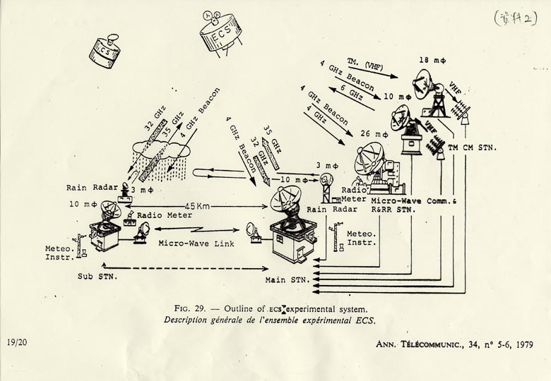
[Slide 2]
At that time, in the studies of radio wave attenuation by rain, measurements were done by transmitting the wave horizontally through the rain region and measuring rain rate by rain gage just under the wave on the ground, and then the data were treated statistically. In this method, it took over 10 to 20 years to collect data to get results. Because satellites cannot usually work this long, and especially because the radio wave from the satellite comes from very high altitude, we thought about a different way of measuring rain phenomena by rain radar like this.
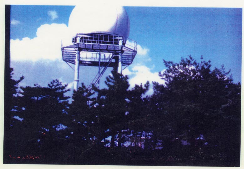
[Slide 3]
In those days many rain radar, such as the Mt. Fuji radar, were used, but they were only qualitative and not so quantitatively reliable. When you place radar on the ground, all rain in this half sphere region (see also: Slide 2) are observed and the rain rates of any cross section are indicated.
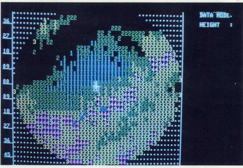
[Slide 4] [Slide 5] [Slide 6]
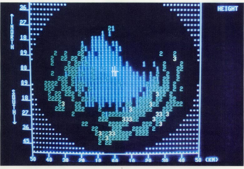
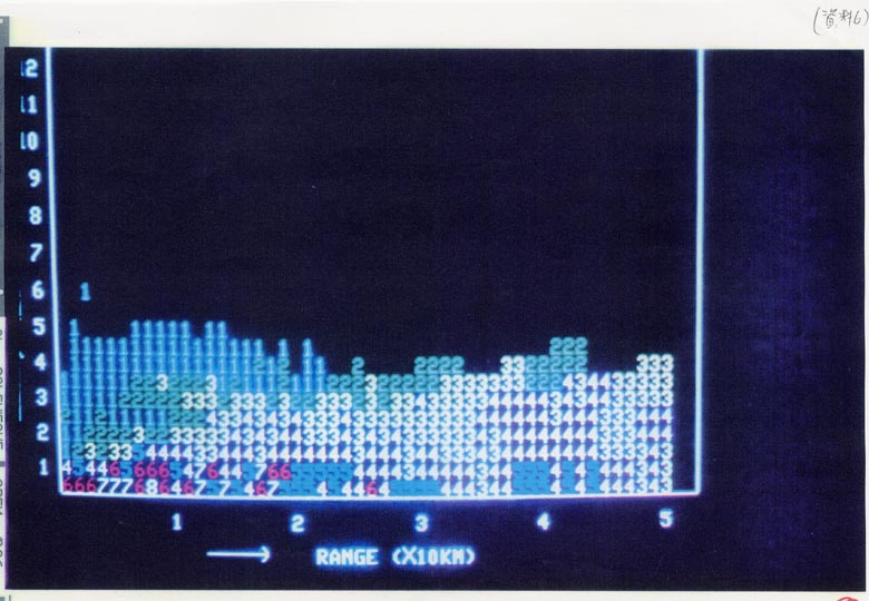
This figure shows the distribution of rain rates on a horizontal plane at an altitude of 2 or 4 km. Although the quality of the output was the highest with the electronics technology at that time, we couldn't print the figures in color; ladies doing part time work put colors in them. Please try to remember this figure (Slide 4). This is the situation at a different altitude (Slide 5), and this is the vertical distribution of rain rates (Slide 6). The radio waves from the satellite propagate toward the earth's surface through the rain in this way.
After several years, the first stage of the satellite communication research was completed and gradually being transferred towards practical use. As one of the next projects, we planned the application of radar technology for measuring global rainfall from space. We wished to use the technology, which we had established to measure rains quantitatively by using satellites. As I said earlier, this idea just fitted to my previous hope to make a project observing something of earth from space using radio wave.
Detailed rain data in Japan is precisely collected by the AMEDAS system. It's a rare case compared to other parts of the world. It's practically impossible to obtain rainfall data over the sea that covers more than 2/3 of the earth surface. Even on the ground surfaces, only developed and well-populated countries gather rain data. For example, in Africa, where there is often famine due to drought, it's not clear whether there is really scarce rain, or whether the pattern of rainfall has shifted to a slightly different place, or even whether there are other human-induced, causes.
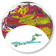
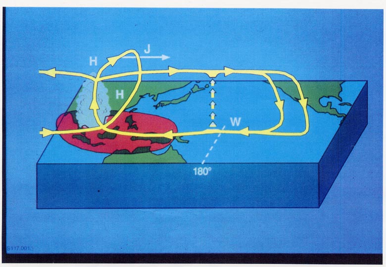
[Slide 7]
In addition, rain is the driving engine for the global circulations of atmosphere and ocean. This is a map of the Pacific Ocean. In western Pacific Ocean including South-East Asia, Indonesia and the Philippines, there are extremely shallow seas on which one can walk to a distant island.
Seawater is warmed and evaporates rapidly, and then the steam brings up a huge amount of heat energy to the upper atmosphere. In midair the steam is cooled and changes to rain. As a result huge amount of heat energy is released there.
Then the temperature in that region increases a great deal, and strong air up-current develops followed by a flow of air blowing into the region from surrounding area. The phenomenon causes the global atmospheric circulation.
|
|
|