| Charles Elachi |
 |
|
|
 |
 |
|
[Slide 30]
[Slide 31]
[Slide 32]
[Slide 33]
[Slide 34]
[Slide 35]
|
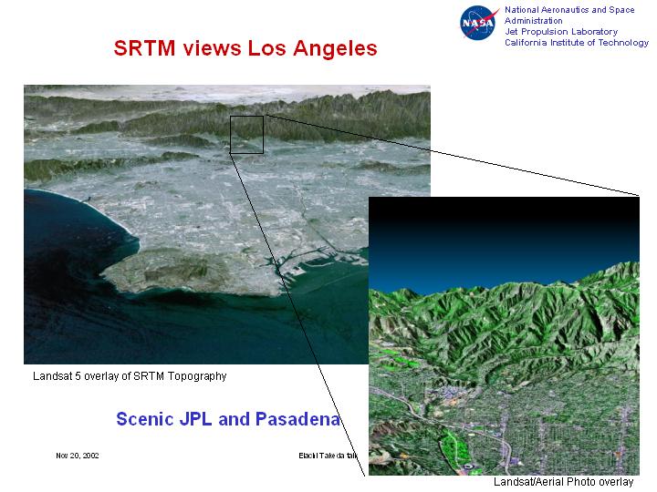
[Slide 30]
Now to focus even more in this area, this show you now by representing these images in three dimension, this is the Los Angeles basin, these are the mountains, and if you zoom here, this shows you the city of Pasadena, and these are the mountains behind JPL, the Jet Propulsion Lab, and this is a free way which comes to JPL. So now we have similar data for everywhere around the world in digital format. It can be used for engineering projects. It can be used by pilots for flying their airplanes in the dark because they can now see in three dimensions the scenery in front of them. It can be used to position repeaters for cell phones because now you have three-dimensional topography. These are illustrations of examples that these three-dimensional data can be used for.
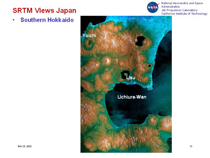
[Slide 31]
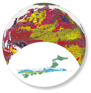
Now let me show you two examples over Japan. Again this is topography of Japan - white is high altitude and blue is low altitudec this is the ocean.
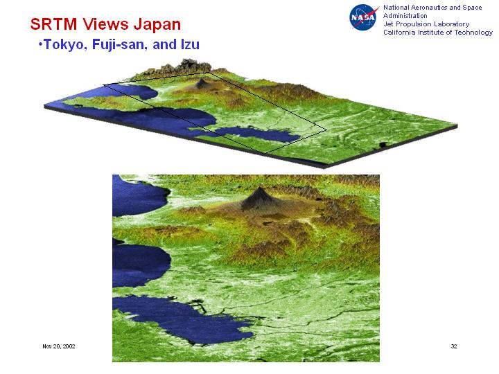
[Slide 32]
Coming closer to where we are, here, this is the area around Tokyo - the Tokyo bay here, Fuji-san up here. This is a more detailed image of Fuji-san in three dimensions and the bay of Tokyo in here.
Now I am going to show you once you get the three dimensional image, now you can fly, you know, over them.
[Slide 33]
So when you have a three-dimensional image, then you can put them in this kind of form, and you can fly over the Tokyo region seeing Mount Fuji in here. If you were a pilot, and if you have this data, you can actually do this kind of flying over them. So now for anywhere around the world, you can have this kind of capability once you get that data. As I mentioned we have now this data for anywhere around the world, it's in a final stage of processing and you can get it on a disc for any region in digital form.
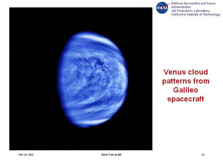
[Slide 34]
The same kind of technology is being used to look at other planets. This is the planet Venus. It turns out that that planet is completely cloud covered, and therefore, you cannot see it with the camera - you can see only the clouds. This is a picture of that planet taken by the Galileo spacecraft and all that you see are the clouds.
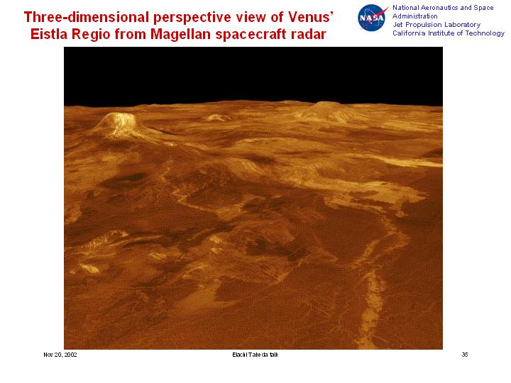
[Slide 35]
Then about ten years ago, we used a similar technique of radar to look at the surface and to be able to penetrate through these clouds, and that is what you see here. We acquired three-dimensional images, and now you can see the Venus' structure of the surface, you can see volcanic activities here, you can see lava flows similar to what's happening on our planet, below that cloud cover, on Venus.
This gave you a kind of an illustration of not only application to our own planet but also to other planets. Looking at the future. A radar instrument is presently going on a spacecraft towards Saturn on a mission called Cassini, and the intent is to image the surface of the satellite Titan, because that surface is completely cloud-covered, like Venus, and we have never seen the surface. So the hope is that we will be able to image the surface of that satellite in the year 2004. Also similar techniques are going to be used at looking at Mars to be able to penetrate below the surface of Mars, and see if there are any old river channels similar to what I showed you earlier in the case of the desert in Northern Africa.
So hopefully this gave you a quick overview of this technology. I should mention now that Japan is a major playerin this field. Japan has flown a satellite, or a number of satellites, with imaging radar on them, and we have had a number of collaboration between my institution JPL and Japan in this field. And this field which used to be mostly research 20 years ago, now is being used for a number of applications.
Thank you very much and I will be glad to answer any questions.
|
|
|