| Ken'ichi Okamoto |
 |
|
|
 |
 |
|
[Slide 1]
[Slide 2]
[Slide 3]
[Slide 4]
[Slide 5]
[Slide 6]
|
[Slide 1]
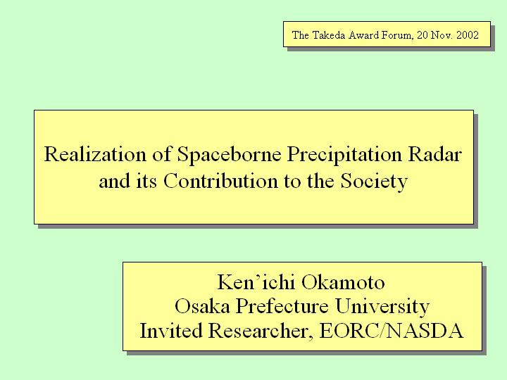
Thank you very much for the introduction. My name is Ken'ichi Okamoto. I work for Osaka Prefecture University. This year I am also working for the Earth Observation Research Center of the National Space Development Agency of Japan (NASDA), as an invited researcher. The title of my presentation is "Realization of Spaceborne Precipitation Radar and Its Contribution to the Society." This work was mainly done while I worked at the Communications Research Laboratory (CRL), Ministry of Posts and Telecommunications.
[Slide 2]
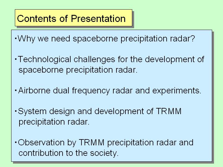
This is the contents of my presentation. First of all, I will tell you why we need the spaceborne precipitation radar. Actually the spaceborne precipitation radar was realized for the first time in TRMM satellite. I will explain mainly the technological issues to be overcome for the realization of the spaceborne precipitation radar and show why it took so many years to achieve this work. Spaceborne precipitation radar has been anticipated for a long time since the 1960s, the era of the first meteorological satellite. Through the system design, we had the perspective to perform this work. As we got some budgets from the CRL, we developed an airborne precipitation radar and did the experiment, as Dr. Fugono already mentioned. As a result of airborne experiment, we became certain that we could succeed in this work. I will talk a little bit about this. We had gone through many challenges and difficulties before the TRMM project started. When the TRMM project had initiated, I was in charge of the design of the radar system from the first stage. I will talk a little bit about this. As the software is very important as well as hardware for the development of the spaceborne precipitation radar, so I will talk about this. At the end I will talk about the actual results of TRMM and their contributions to the society.
[Slide 3]
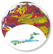
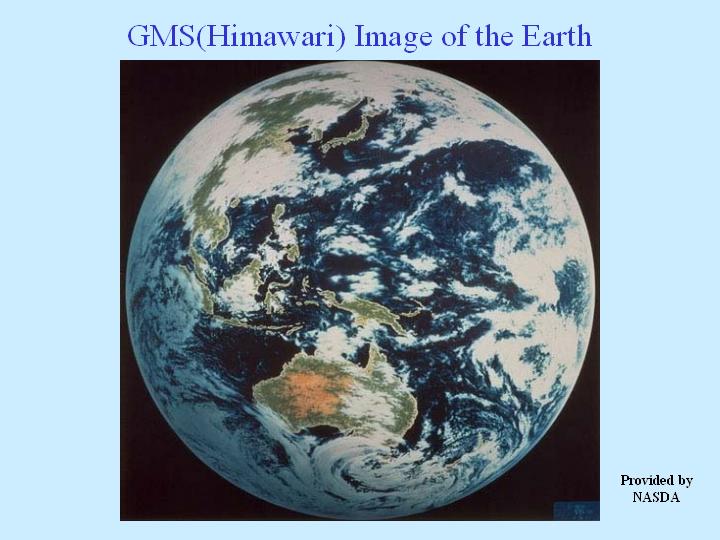
In the first place, I will talk about why we need the space borne precipitation radar. As you know well, this is the image observed by "Himawari," the Geostationary Meteorological Satellite. As you can see, you can easily understand why the earth is called a 'water planet.' The earth is abundant in water, clouds are forming, and many life activities are taking place. The earth has a rare environment in the whole universe. It is our duty to protect this global environment and pass it down to the next generation. "Himawari" offers the marvelous visible and infrared cloud image of this water planet, the earth. And this provides information concerning typhoons and other large meteorological systems, which cause many disasters. This information is very useful to prevent the loss of many precious lives. However, visible and infrared images cannot find out where the rain is under this cloud. Since the launch of the TIROS-1 meteorological satellite on April 1, 1960, we felt the necessity for a spaceborne precipitation radar in the meteorological community. Before I talk about why it wasn't realized, let me briefly show you the principle and logic of precipitation radar.
[Slide 4]
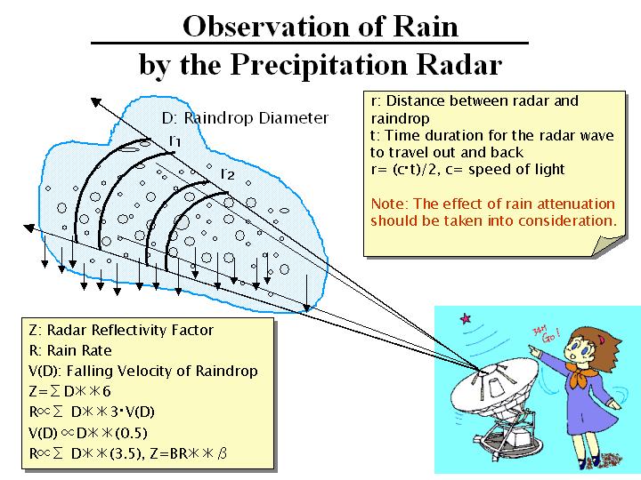
As shown in this slide, many raindrops exist in the air when it's raining. Radar waves (radiowaves from radar) hit the raindrops and radar receives the scattered echo by the raindrops. The larger the number of large size raindrops in the air, the stronger the scattered radar wave that can be received. When a lot of large size raindrops exist, it means heavy precipitation. So, the stronger scattered radar wave tells us that there is heavy precipitation. Actually when using radar, we measure the value "Z." "Z" is given as the summation of the 6th power of D, the diameter of the raindrop. It means we directly measure the amount of scattered radar wave. The rainfall rate "R" of precipitation is defined roughly as the summation of the 3.5th power of D. By using radar, we measure the value "Z" instead of directly measuring the value of "R", the rainfall rate. We estimate the value "R" from the measured value "Z." Therefore the algorithm is very important. Please remember this issue. To make the issue more complicated, the scattered radar wave is attenuated by the existing raindrops. The rain attenuation is a very big issue for the precipitation radar. The shorter the wavelength and the higher the frequency of the radar wave, the larger the attenuation that occurs. In the ground radar, we want to measure precipitation at greater distances and suppress the rain attenuation as far as possible by using longer wavelength, i.e. 5 to 6 cm. That's the reason why the instrument becomes larger in the ground radar.
[Slide 5]
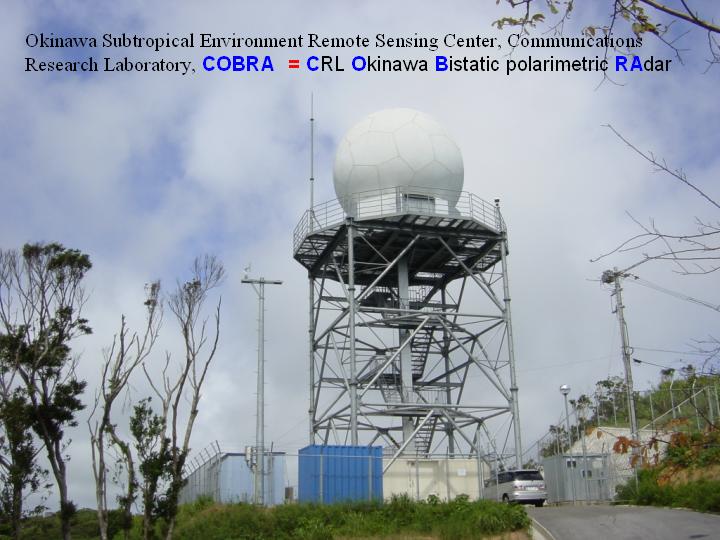
This shows the radar system at Okinawa Subtropical Environment Remote Sensing Center of the CRL. This is the world most advanced Doppler polarization radar and is used for measuring various parameters on precipitation. Inside the 8 m diameter radome, a 4.5m diameter antenna is rotating. A frequency of about 5 GHz is used and the wavelength is about 6 cm. If you compare it with the size of the car in the viewgraph, you can understand how big this radar is. And also this system consumes a large amount of power, so we were quite reluctant to launch such a big radar system on a satellite.
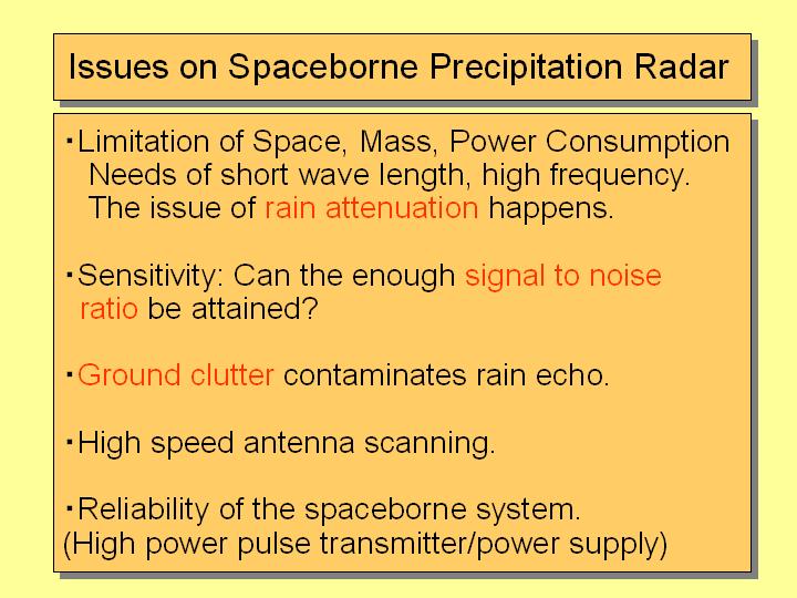
[Slide 6]
The issues on the spaceborne precipitation radar are shown in this slide. As I mentioned before, there are limitations of space, mass, and power consumption. Space and resource are strictly limited in a satellite, so the instruments must be compact and small. Since the size of instrument is proportional to the wavelength, a shorter wavelength should be used. The shorter radio wave is attenuated heavily by precipitation, so the issue of rain attenuation became serious. This was a very complicated and cumbersome matter. The distance between a satellite and the earth is very large and moreover, the rain attenuation occurred. There was the question of whether a sufficient signal-to-noise ratio could be attained to measure the precipitation. Then there is the ground clutter issue. Ground clutter contaminates the rain echo, so we had to assess it. These issues, as shown in red, show why we couldn't achieve a space borne precipitation radar. I had just started to work for CRL in 1977 and did the calculations to examine whether the spaceborne precipitation radar system is feasible or not. Due to the result of this calculation, I had a feeing that it might be possible to achieve.
|
|
|